


Finding Answers in the River
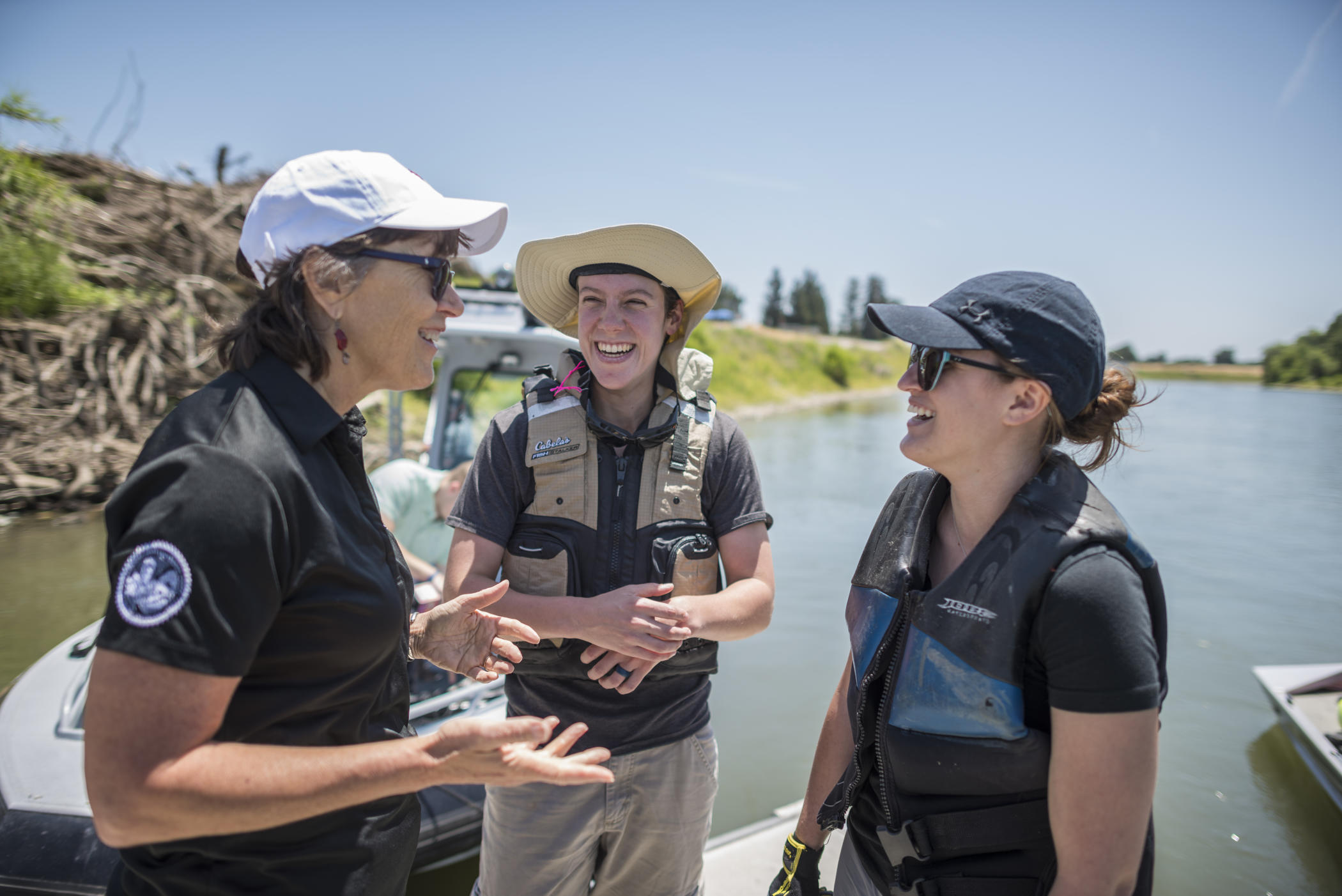
President Gayle Hutchinson (left) talks with anthropology graduate students Valerie Sgheiza (center) and Mallory Peters (right) in assistance with the Geographical Information Center and sheriff-coroners in the local counties conduct a demonstration of a research project developed in response to needs identified by emergency personnel that respond when people are lost to drowning on the Sacramento River on Thursday, June 7, 2018, at the Tisdale Boat Launching Facility Boat ramp in Sutter County, Calif. The project, Fluvial Transport of Human Remains: Forensic Application of a HEC-RAS Model for Predicting Search Parameters for Human Remains Recovered from the Sacramento River, California, uses field tests where rescue manikins are deployed in the river and then the flow distance are input to the hydraulic model. The ultimate goal of the project is to develop a mobile application where public safety personnel input the flows on the date a person was lost and the app returns a search area. (Jason Halley/University Photographer/CSU Chico)
The fisherman was steering his boat across a lazy bend of the Sacramento River when he saw the bodies being pulled from the water.
Four boats, one a clearly marked sheriff’s vessel, had converged on two half-submerged figures. The angler raised a startled hand to his mouth for only a brief moment, then noticed the fluorescent orange and yellow hues of the floating bodies.
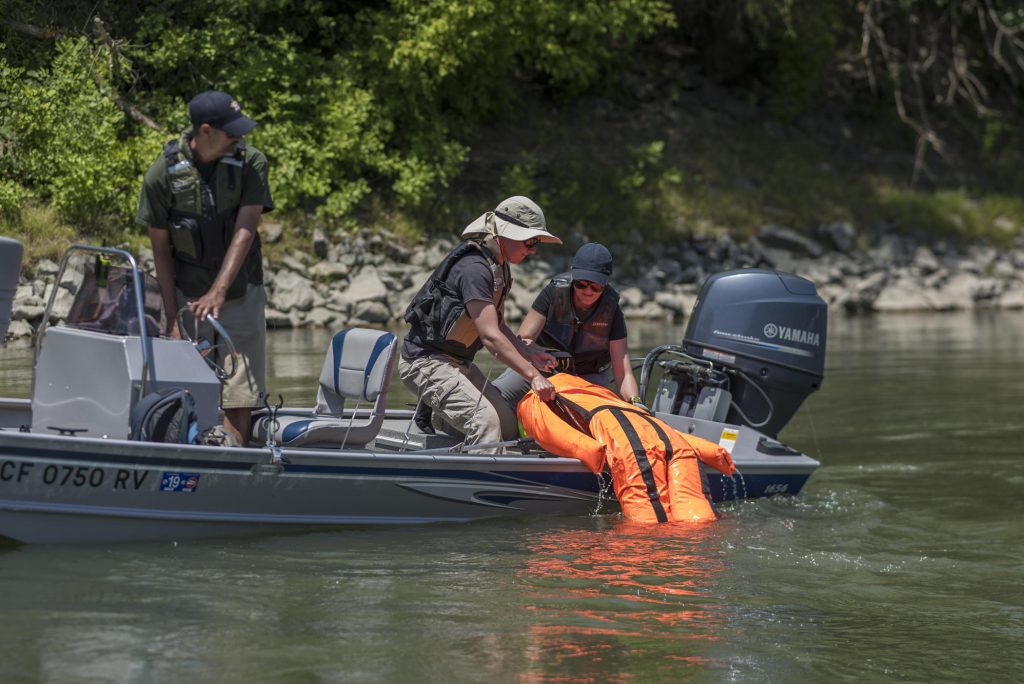
He took a second to return the friendly wave from the deputy’s craft as the boats went on with their research. With a relieved laugh and a palm to his forehead, he admitted, “Boy, that was scary.”
The actual nature of the work on the water that day, a mid-90s one in early June at the Tisdale launch ramp in Sutter County, was motivated by real-life discoveries similar to the one the fisherman thought he had moseyed upon. Professors Colleen Milligan and Eric Bartelink from Chico State’s Department of Anthropology have been working for the better part of two years on research like this with the University’s Geographical Information Center (GIC), studying the river’s flows and other variables that affect how objects—namely, human bodies—may carry downstream in a given set of conditions.
With $800,000 in grant support from the National Institute of Justice and help from a small graduate student team, the GIC and Departments of Anthropology and Civil Engineering aim to convert their findings into useful technology for law enforcement, search and rescue, and coroners’ offices to establish predictable patterns in drowning cases and decrease recovery times. Bartelink said this project is the first of its kind in the world.
In the cases of people reported missing near bodies of water, Milligan said, every hour that goes by before recovery not only makes them more difficult to identify, but also exponentially increases anxiety of those searching for them. Whether someone enters a waterway accidentally or through foul play, she said, time is a critical factor.
“At the heart of it, whenever you have bodies coming out of the river, you have to remember they were someone,” Milligan said. “They’re part of a family, they have loved ones, people that care about them. This is about making sure you can have as high of a success rate as possible in returning people to families and making sure you have the best chance to bring justice and closure.”
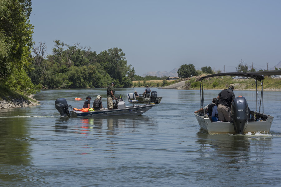
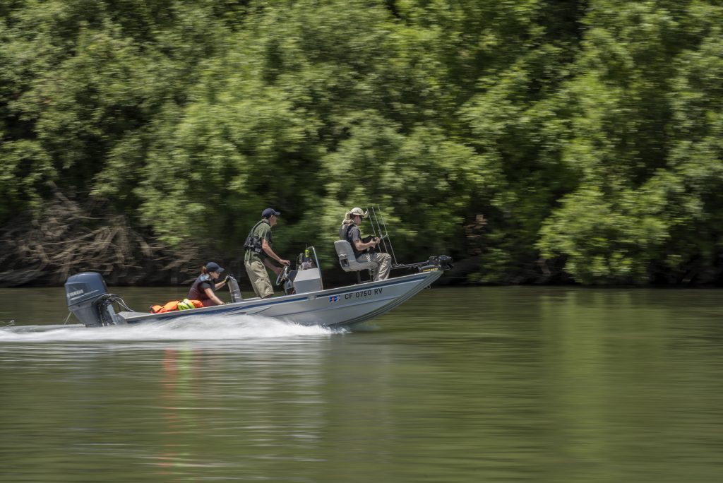
In addition to a database of recovery information from sheriffs and coroners, the researchers are creating simulations on the river to establish more data. Using models equipped with the same GPS devices used to track salmon on the Sacramento River, the GIC spends the day dropping the dummies into the water, then following them for as long as they float or until they run ashore. River entry points often change to create more data points, and the researchers check to confirm corresponding flow rates. The research team considers three levels of flow—low, medium, and high—and only tests in the low range of the high-flow conditions, for safety purposes.
Even outside of its most turbulent conditions, the swift Sacramento River provides a challenging environment in which to recover bodies. Ample underwater brush, variable Central Valley winds, and fluctuating runoff levels all add layers of difficulty to every search.
“Growing up in California, you see it every year—somebody goes into the river,” said Mallory Peters, a third-year anthropology graduate student. “So there’s a lot of value in understanding the way bodies transport and the role that flow rates, seasonality, and temperature all play in recovering them. It’s interesting to get the forensic and anthropological experience of it from this side, but it’s also just a great way to make information public that people can understand.”
The test mannequins used in the study—or hydraulic models, as the researchers call them—commonly see use across the nation in flood analysis, according to the GIC. Chico State hydrologist Steffen Mehl helped Bartelink, Milligan, and the rest of the research team conceive the idea to calibrate them for use in flow research. The floating models (the traffic cone-orange version seen coming out of the river by the fisherman) weigh about 75 pounds dry, take on an almost equal amount in water weight, and are modified with an air-filled chest cavity to float at 45 degrees, as a corpse with slowly deflating lungs might. Another model, all black in color, heavier and more porous, is designed to submerge quicker to simulate a body in a later stage of decomposition. The team can’t yet account for every factor that befalls a human body, of course: Real decay is difficult to mimic, limbs detach as the body becomes waterlogged, and wildlife scavengers are bound to further complicate the body’s travels.
But the flow rate is the primary factor in play, and a few extraordinary examples of how far a body can travel in one waterway stand out as prime exhibits for the importance of this team’s research, Bartelink said. Recently, a body that was known to enter the river in Redding turned up not far from this very launch ramp—about 180 miles downriver. In another instance, the shoe-wearing foot of a drowning victim surfaced 54 miles from where the body was known to enter the river.
“We learned, somewhat to great surprise, that the range is much larger than we might have guessed,” Bartelink said. “So, we know it’s possible, and now we want to make it more apparent to law enforcement that it’s a factor to consider when they are searching. In low-flow conditions, you’ll probably find it within a mile. In high-flow conditions, well, a lot more is in play. We want to give them the tools and information they need so they can do their jobs the best they can.”
The application of that outcome might be exactly that—an application. A smartphone app to essentially set a possible radius on the map, using the data gathered in this research, is the practical tool search crews could rely on to expedite the process. Sutter sheriff’s boat deputy Zach Berg said such an app would be invaluable to search and rescue units.
“The only information we’ve had to go on is our observations over the years, so at best, it’s always been an educated guess, based on where they fell in the water. We’re working off memories,” Berg said. “This has some real science behind it, real percentages to work with. It’ll help us recover bodies faster and help us provide answers for upset families who are looking for them. I think it’ll be a huge benefit to us.”